Forecast for the Logan Area Mountains

Issued by Toby Weed on
Tuesday morning, December 29, 2020
Tuesday morning, December 29, 2020
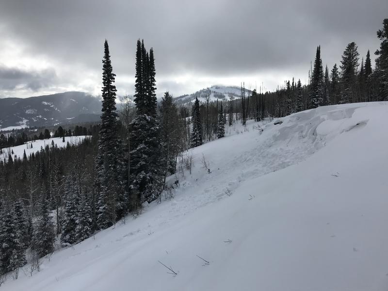
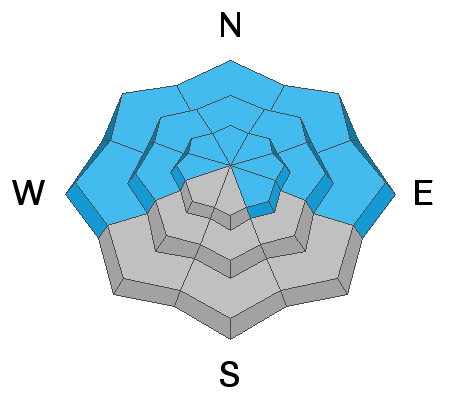
There are areas with CONSIDERABLE danger on steep drifted slopes at upper and mid elevations. Strong and sustained east winds yesterday stripped the powder off of upper elevation slopes facing the east half of the compass and built drifts and wind slabs in unusual and perhaps unexpected places. People could trigger dangerous avalanches consisting of drifted snow failing on a sugary persistent weak layer. Slab avalanches, 1 to 3 feet deep, are likely in some areas, and could be triggered remotely or from a distance.
- Shallow snow coverage dictates careful travel, and hitting rocks and other obstacles still presents a serious risk in the backcountry.
- Cracking and collapsing indicate unstable snow.
- Continue to avoid and stay out from under drifted slopes steeper than about 30 degrees.

Low
Moderate
Considerable
High
Extreme
Learn how to read the forecast here