Forecast for the Logan Area Mountains

McKinley Talty
Issued by McKinley Talty on
Friday morning, January 30, 2026

In most areas, the avalanche danger is LOW. Pockets of MODERATE danger exist on upper-elevation slopes facing north through southeast, where human-triggered avalanches of wind-drifted snow up to one foot deep are possible.

Low
Moderate
Considerable
High
Extreme
Learn how to read the forecast here
Weather and Snow

A few inches of low-density snow on Wednesday evening brought a fresh look to the Logan mountains. Riding conditions improved slightly, but it's the frosted pines and thin coat of new snow covering old tracks that really make the peaks glisten. At lower elevations, solar slopes facing southeast through west are mostly bare, and snow coverage remains exceptionally thin at lower and mid-elevations. Watch for rocks, downed trees, and barely covered branches in these areas. At upper elevations, snow surfaces are highly variable. Sunny slopes hold dust-on-crust conditions, while cold, north-facing slopes contain extremely weak, sugary snow beneath yesterday's dusting.

This morning at the UAC Card Canyon weather station at 8700 feet, it's 18°F, and there is 43 inches of total snow. The Tony Grove Snotel at 8400 feet reports 22°F and 56 inches of total snow. On Logan Peak at 9700 feet, winds are blowing 19 mph from the northwest, gusting to 25 mph. It's 17°F on Paris Peak at 9500 feet, and the wind is blowing 15 mph from the west, gusting to 20 mph. Moderate west-northwest winds last night and today may continue to create pockets of wind-drifted snow resting on top of weak, sugary facets.

Fog will persist in the Cache Valley today, but it can be escaped by a quick drive up Logan Canyon. Mostly clear skies this morning will give way to partly cloudy conditions this afternoon. Winds will increase slightly throughout the day, blowing 20 mph from the northwest and gusting to 30 mph. Temperatures are expected to climb to 25°F today and will continue to increase through the weekend. Looking ahead, we expect dry conditions to persist through next weekend.

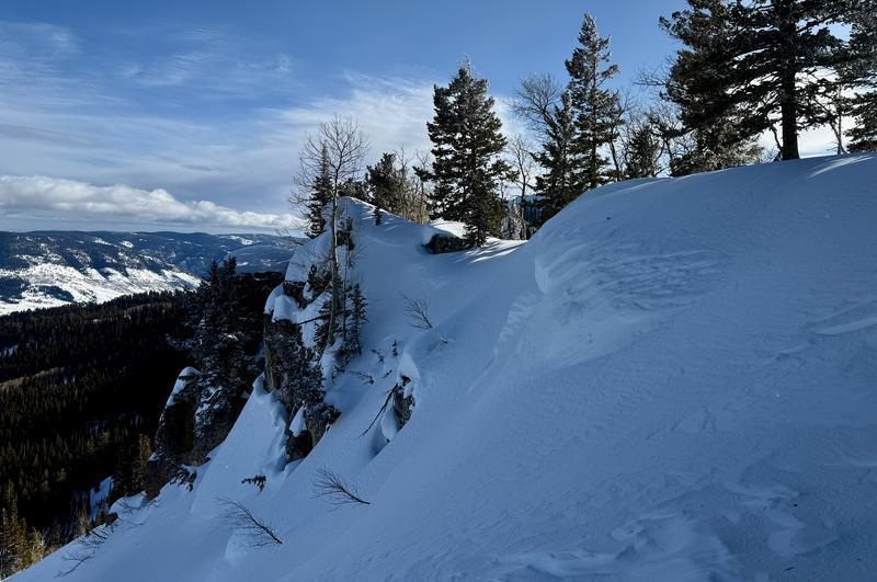
Textured snow surfaces indicate wind-drifted snow. Watch for slopes where the snow appears to be rounded, smooth, and pillowy.

Yesterday, we hosted a Backcountry 101 in Steep Hollow. Thank you to everyone who joined us on the snow!

Recent Avalanches

No avalanches have been reported recently. For all observations and avalanche activity in the Logan Zone, go HERE.

Avalanche Problem #1
Wind Drifted Snow
Type
Location
Likelihood
Size
Description

It is possible for humans to trigger small avalanches of wind-drifted snow where wind slabs formed by redeposition on preexisting weak surface snow consisting of near-surface facets or surface hoar in exposed upper-elevation terrain.

  • Avoid and stay out from under stiffer pockets of recently drifted snow on steep slopes.
  • Wind slabs may have formed or have been cross-loaded in and around terrain features like mid-slope roll-overs, gullies, under cliff bands, or sub-ridges.
  • Suspect wind slabs are often chalky, rounded, and smooth, and they can sound hollow, like a drum. Shooting cracks and whumpfs obviously indicate instability.
  • Small loose avalanches of sugary, faceted snow are possible on very steep slopes.

A layer of surface hoar and small near-surface facets is now capped, buried shallowly, and preserved by fresh snow; this will likely become a problematic, persistent weak layer. Drifts of new snow forming on this layer of preexisting weak surface snow are likely to be sensitive to human triggering.

Additional Information

***Travel with a partner, and cross or ride slopes steeper than 30 degrees one at a time while the rest of your group watches from a safe spot.

Ensure that everyone in the group has avalanche rescue equipment (a transceiver, probe, and shovel) and knows how to use it. Now is a great time to get out in the mountains, explore new terrain, and practice companion rescue with your backcountry partners.

Did you know the UAC hosts a podcast? Episode 2 of Season IX is just out - AI, Machine Learning, and the Value of Expert Intuition at the Utah Avalanche Center.

Are you interested in learning more about avalanches? Visit our education page for details on all our classes.

For more information, visit the UAC weather page here: UAC Weather Page For Logan-specific weather, go here: Logan Mountain Weather

-For all questions on forecasts, education, Know Before You Go, events, online purchases, or fundraising, call 801-365-5522.

-Remember, the information you provide could save lives, especially if you see or trigger an avalanche. To report an avalanche or submit an observation from the backcountry, go HERE

-Receive forecast region-specific text message alerts to receive messages about changing avalanche conditions, watches, and warnings. Sign up and update your preferences HERE

This forecast is from the U.S.D.A. Forest Service, which is solely responsible for its content. This forecast describes general avalanche conditions and local variations always occur.

General Announcements
This information does not apply to developed ski areas or highways where avalanche control is normally done. This forecast is from the U.S.D.A. Forest Service, which is solely responsible for its content. This forecast describes general avalanche conditions and local variations always occur.