Forecast for the Logan Area Mountains

Paige Pagnucco
Issued by Paige Pagnucco on
Saturday morning, January 24, 2026

The avalanche danger is LOW, and avalanches are unlikely. Watch for unstable wind-drifted snow in upper elevation terrain.

Low
Moderate
Considerable
High
Extreme
Learn how to read the forecast here
Special Announcements

***Join us for a Backcountry 101 for snowmobilers on January 28 and 29. This life-saving course is designed for snowmobilers and snow bikers taking their first on-snow avalanche class or looking to refresh previous training. For more information and to sign up, click here.

Did you know the UAC hosts a podcast?

Episode 2 of Season IX is just out - AI, Machine Learning, and the Value of Expert Intuition at the Utah Avalanche Center.

Weather and Snow

The "storm," or really just some clouds, moved through our area pretty quickly yesterday, leaving behind no new snow, more than a few disappointed riders, and, to add insult to injury, colder temperatures. Utah, like much of the Intermountain West, is struggling to hit average SWE (snow water equivalent) for the season, minus a few SNOTEL stations in the Uintas and at Tony Grove, which is 103% of normal this morning. We need a significant shift in the pattern to get back on track. The next chance for a weather change is possibly later next week, but the models are highly uncertain right now.

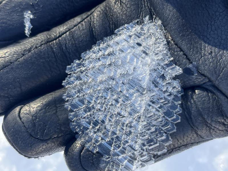
Slopes exposed to the sun will be firm and crusty this morning and may not soften at all today, given the colder temperatures. Sheltered, northerly slopes are holding recrystallized, weak snow, making for "loud powder" riding. Snow depths in low and mid-elevations are exceptionally thin, creating hazardous travel conditions due to rocks, downed trees, and barely covered branches.

This morning at the UAC Card Canyon weather station at 8700 feet, it's 10°F, and there is 41" of total snow. The Tony Grove Snotel at 8400 feet reports 11°F and 54" of total snow. On Logan Peak at 9700 feet, winds are blowing in the teens from the northwest, gusting to 21 mph. It's 8°F (wind chill is -7°F) on Paris Peak at 9500 feet, and the wind is blowing in the teens from the north. Today will be cold and sunny in the mountains, with highs in the teens F and light winds blowing from the north-northwest.

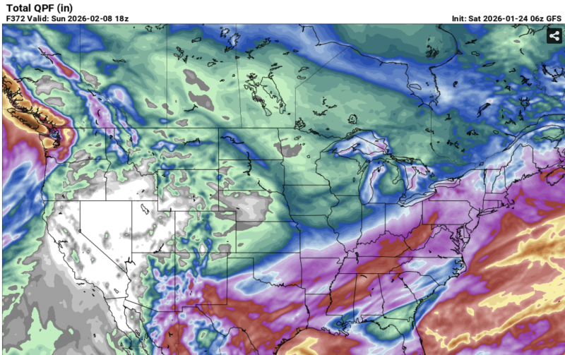
The GFS run for the next two weeks looks pretty grim. Like I said a while ago, if you are looking for powder, head east.

Recent Avalanches

No avalanches have been reported recently. For all observations and avalanche activity in the Logan Zone, go HERE.

Avalanche Problem #1
Normal Caution
Type
Location
Likelihood
Size
Description

Traveling conditions are ok in the backcountry, and the snow is generally stable. You can expect generally safe avalanche conditions, but remember, LOW danger doesn't mean there's NO danger. Now is a great time to get out in the mountains, explore new terrain, and practice companion rescue with your backcountry partners in the fresh air and sunshine.

  • Watch for and avoid stiff drifts or wind slabs formed by redeposition on weak surface snow consisting of near-surface facets or surface hoar.
  • The surface snow continues to weaken, and small loose avalanches of sugary, faceted snow are increasingly possible on very steep slopes.
  • Travel with a partner, and cross or ride slopes steeper than 30 degrees one at a time while the rest of your group watches from a safe spot.
  • Ensure that everyone in the group has avalanche rescue equipment (a transceiver, probe, and shovel) and knows how to use it.

Surface hoar, pictured above, is just one of the many weak surface layers we are currently tracking. While super fun to ride through, this beautiful frost crystal can, once buried, become a persistent weak layer.

Additional Information

Use safe travel practices: travel with a partner, and cross or ride steep slopes one at a time while the rest of your group watches from a safe spot.

Are you interested in learning more about avalanches? Visit our education page for details on all our classes.

For more information, visit the UAC weather page here: UAC Weather Page For Logan-specific weather, go here: Logan Mountain Weather

-For all questions on forecasts, education, Know Before You Go, events, online purchases, or fundraising, call 801-365-5522.

-Remember, the information you provide could save lives, especially if you see or trigger an avalanche. To report an avalanche or submit an observation from the backcountry, go HERE

-Receive forecast region-specific text message alerts to receive messages about changing avalanche conditions, watches, and warnings. Sign up and update your preferences HERE

This forecast is from the U.S.D.A. Forest Service, which is solely responsible for its content. This forecast describes general avalanche conditions and local variations always occur.

General Announcements
This information does not apply to developed ski areas or highways where avalanche control is normally done. This forecast is from the U.S.D.A. Forest Service, which is solely responsible for its content. This forecast describes general avalanche conditions and local variations always occur.