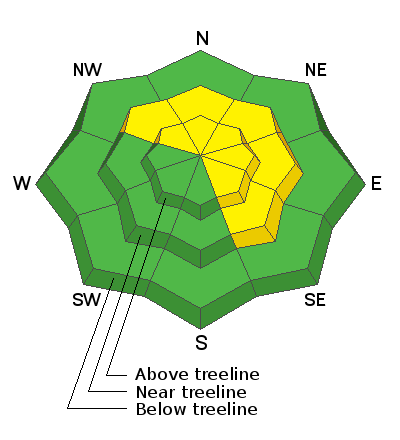
Forecast for the Abajos Area Mountains

Issued by Eric Trenbeath on
Wednesday morning, January 15, 2020
Wednesday morning, January 15, 2020
A MODERATE danger exists on steep, wind drifted slopes that face NW-N-SE where strong SW winds have blown and drifted snow on to leeward slopes. I Suspect areas that have a smooth, rounded look or hollow feel to them. High winds have caused slabs to form down-slope from ridge crests, and special attention should be paid to slopes that have steep convexities or blind break overs. In these same areas, a triggered wind slab may step down into a buried weak layer causing a deeper and more dangerous avalanche. Most other terrain has generally LOW danger.

Low
Moderate
Considerable
High
Extreme
Learn how to read the forecast here


