

| Advisory: Logan Area Mountains | Issued by Toby Weed for January 2, 2013 - 6:51am |
|---|


Above 8,500 ft.
7,000-8,500 ft.
5,000-7,000 ft.
|
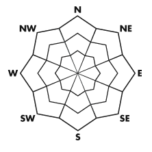
bottom line The snow is mostly stable and the overall danger is LOW (or level 1) in the backcountry today. Heightened avalanche conditions still exist in places, and there are areas with a MODERATE (or level 2) danger at upper elevations. You could trigger wind slab avalanches in drifted terrain or loose dry sluffs on very steep slopes. Although becoming rather unlikely, dangerous persistent slab avalanches are possible in areas with generally shallow and weak snow. Use normal caution and continue to practice safe travel protocols.
|
 |
special announcement The friends of the Utah Avalanche Center in Logan is presenting an Advanced Skills backcountry 201 class this week. A classroom session on the evening of January 3 and a field day on Saturday January 5. Here's a link for more information and registration; Advanced Skills, backcountry 201 or call 435-757-2794. There will also be a snowmobile avalanche safety clinic in Logan, with a classroom session on Thursday.January 17 and a field session up at Tony Grove on Saturday January 19. Save the date, call 435-757-2794 for more information, and we'll have more registration information posted on our Website soon.... |
 |
current conditions You'll find good, fast, re-crystallized powder conditions today in many areas. But, some drifting occurred and is continuing in exposed terrain at upper elevations, even though the northerly winds still aren't all that strong. The Tony Grove Snotel at 8400' reports 8 degrees this morning, 45 inches of total snow, and 85% of average water content for the date. Wind information is rather limited this morning, but Beaver Mt. and UDOT hwy 89 Logan Summit are both showing wind speeds in the lower single digits... The fine powder from last week is settling out a bit and the surface is starting to re-crystallize, while frost or feathery surface hoar is also forming on the surface. You'll find a rather weak crumbly crust on south facing slopes.
|
 |
recent activity We've noticed evidence of natural avalanche activity in some areas that occurred during last week's storm. My party triggered a sizable loose dry sluff up in Deep Canyon in the Wellsville Mountain Wilderness on Monday. No avalanches were reported in the Logan Area yet in 2013... Here's a link to our avalanche list...
|
| type | aspect/elevation | characteristics |
|---|
 |


Above 8,500 ft.
7,000-8,500 ft.
5,000-7,000 ft.
|
|
|
description
With all the light holiday powder around, it didn't take much wind to build shallow wind slabs on the lee side of major ridges and in and around terrain features like cliff bands, sub-ridges, gullies, and scoops. In some areas, stiffer wind slabs formed on steep exposed slopes. These may be stubborn and could allow you to get out on them before releasing.. Wind slabs could be found in some rather atypical places today and possible northeast winds at the highest elevations today could make this problem more of an issue.
|
| type | aspect/elevation | characteristics |
|---|
 |


Above 8,500 ft.
7,000-8,500 ft.
5,000-7,000 ft.
|
|
|
description
Triggered loose dry sluffs are still likely on very steep slopes with loose re-crystallized powder, and some of these could pick up energy and more snow in descent on longer slopes..
..
|
| type | aspect/elevation | characteristics |
|---|
 |


Above 8,500 ft.
7,000-8,500 ft.
5,000-7,000 ft.
|
|
|
description
Although becoming less of a threat with time, there are still pockets with poor snow structure where you might trigger dangerous hard slab avalanches releasing on buried persistent weak layers. Outlying steep slopes facing the northern half of the compass with generally shallow and weak snow are the most suspect. An avalanche of this type will probably take a pretty big trigger., and the weight of one person on a slope may not be enough, while two or three on sleds might be.... It'll take a bit of probing or digging to determine, but be wary if you find loose sugary snow in the basal layers. Avalanches running on persistent weak layers might be triggered remotely from a distance or worse, from below. Please report any audible collapsing or whumpfing you may encounter, as this is an important sign of persistent instability. |
 |
weather Expect sunny conditions in the mountains today with high temperatures approaching 20 degrees and a light northwest breeze. Looks like a split pattern has developed and we are stuck in a period of weather controlled by a strong high pressure system. This means fair weather in the mountains and developing and thickening urban haze in the Cache and other northern Utah valleys at least through the weekend.... Check out the Logan Mountain Weather page...
|
| general annoucements Remember your information from the backcountry can save lives. If you see or trigger an avalanche in the backcountry or see anything else we should know about, please send us your snow and avalanche observations. You can also call us at 801-524-5304 or email by clicking HERE. In the Logan Area you can contact Toby Weed directly at 435-757-7578. I will update this advisory on Monday, Wednesday, Friday, and Saturday mornings by around 7:30... This advisory is produced by the U.S.D.A. Forest Service, which is solely responsible for its content. It describes only general avalanche conditions and local variations always exist. |