

| Advisory: Logan Area Mountains | Issued by Toby Weed for November 9, 2012 - 7:26am |
|---|


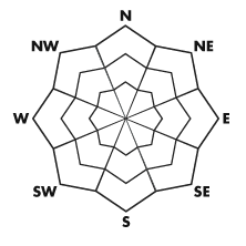
Above 8,500 ft.
7,000-8,500 ft.
5,000-7,000 ft.
|
bottom line Heavy snowfall and sustained west winds will cause the danger to rise to MODERATE today, and you could trigger storm snow or soft wind slab avalanches on steep upper elevation slopes with preexisting snow. Heightened avalanche conditions exist and the danger will increase and become more widespread as significant snow accumulates at upper elevations this weekend.
|
 |
current conditions Today's snow will fall on old snow that only remains at upper elevations and on slopes facing the northern half of the compass... The existing snow is more substantial in the Southern Bear River Range with up to around a foot-and-a-half of dense snow in wind deposition areas On Wednesday we found small-grained, weak, sugary faceted snow just under a fragile and somewhat inconsistent melt-freeze surface crust. on upper elevation north facing slopes. Be sure to check your batteries and the working condition of your rescue equipment, and follow safe travel protocols.... Remember that upper elevation Forest roads including the Tony Grove Road are not maintained for winter travel and are likely to present challenges... Expect rapid accumulations during the day today. Be sure you are prepared with emergency supplies |
| type | aspect/elevation | characteristics |
|---|
 |


Above 8,500 ft.
7,000-8,500 ft.
5,000-7,000 ft.
|
|
|
description
Expect the danger to rise on slopes with preexisting snow through the weekend, with significant snowfall expected through Sunday morning. A foot or two of accumulation and moderately strong west winds are expected.... Soft slabs may fail on weak underlying snow from October, and wind slabs will rapidly form in exposed terrain... |
 |
weather The National Weather Service is continuing a Winter Storm Warning for most of the Utah mountains through early Sunday morning. Expect snow today down to the valley floor, with significant accumulations possible in the mountains. A foot or two is likely to fall by early Sunday morning. Expect moderate westerly winds today ,swinging back around from the southwest tonight. The outlook for early next week calls for fairly benign, warming, and somewhat cloudy conditions. Another system may drive into the state toward the end of the work week, but the timing and course of this are too far out for more than a mention..... |
| general annoucements Check out our new video showcasing last year's (2011-2012) documented backcountry avalanche activity.... https://vimeo.com/52907979 Come join us for our annual "Pray for Snow" fundraiser dinner and party November 29 at The Italian Place! In addition to live music and entertainment we have lots of donated items to raffle off including OR outerwear, Marker A/T bindings and a Voile Splitboard! |